
Dinosaur Trackways And Other Reasons To Love Tumbler Ridge, British Columbia
Published August 7th, 2024
Photography by Jennifer Bain unless otherwise noted.
Lead image credit: Destination BC Jesaja Class

Tumbler Ridge Museum Dinosaura Discovery Gallery CREDIT Destination BC Jesaja Class
How many people can say they’ve stroked dinosaur footprints preserved in their natural environment? After a trip to Tumbler Ridge in northern British Columbia, I can.
Back in 2000, two kids were tubing down the Flatbed Creek rapids when they hit a rock. Mark Turner, 11, flew off and swam to shore, pulling eight-year-old Daniel Helm to safety. Keen for another go at the rapids, the boys were walking up the bedrock on the far bank of the creek when they spotted six strange depressions in the rocks.

Could it be? Experts soon confirmed these four-toed footprints were an ankylosaur (armoured dinosaur) trackway. When Canada’s dinosaur footprint expert arrived to investigate, he also found a foot bone, making this one of the rare places in the world where dinosaur tracks and bones have been discovered beside each other.

Back then, Tumbler Ridge was a one-industry planned community built in 1981 whose coal mines were in a slump. The dinosaur discovery captured international headlines and sparked tourism and economic diversification.
As the fossil and bone discoveries piled up, the Tumbler Ridge Museum Foundation formed and created the Peace Region Paleontology Research Centre and the Dinosaur Discovery Gallery. In 2014, Tumbler Ridge earned UNESCO Global Geopark status (more on that in a minute).
Now this once dying resource town is having a second heyday as an adventure lover’s paradise in a region that Destination British Columbia calls “the Great Wilderness.” Tumbler Ridge isn’t yet on everyone’s Canadian bucket list — it is only 43 years old after all — but it should be.


“I was a dinosaur kid,” says Kai Pettifer as he leads my group down the Flatbed Cabin Pool Dinosaur Footprints Trail after a Tumbler Ridge Museum tour. “Who wasn’t?”
“I wasn’t,” I confess.
“Oh, I feel sorry for your childhood,” he replies.


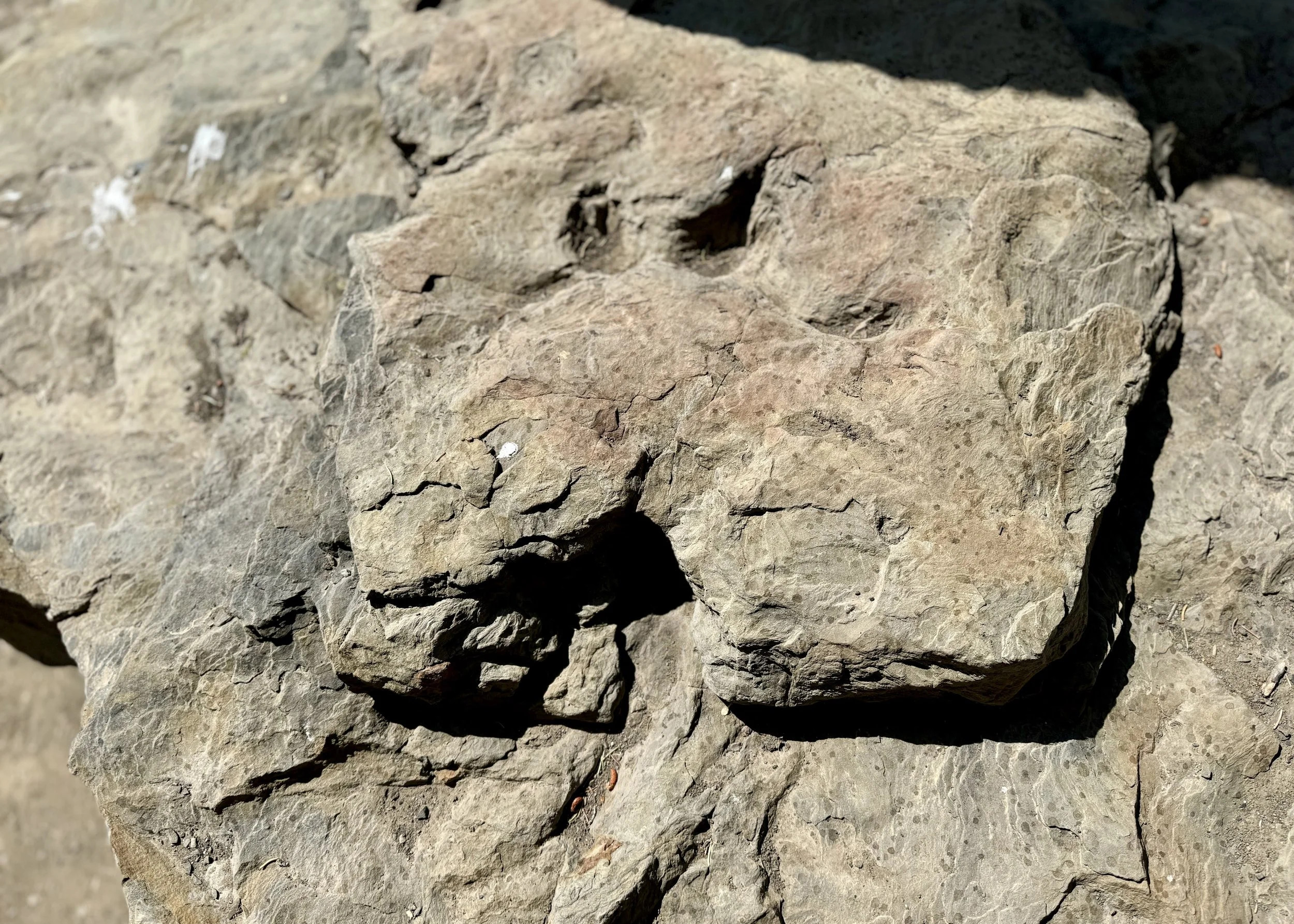
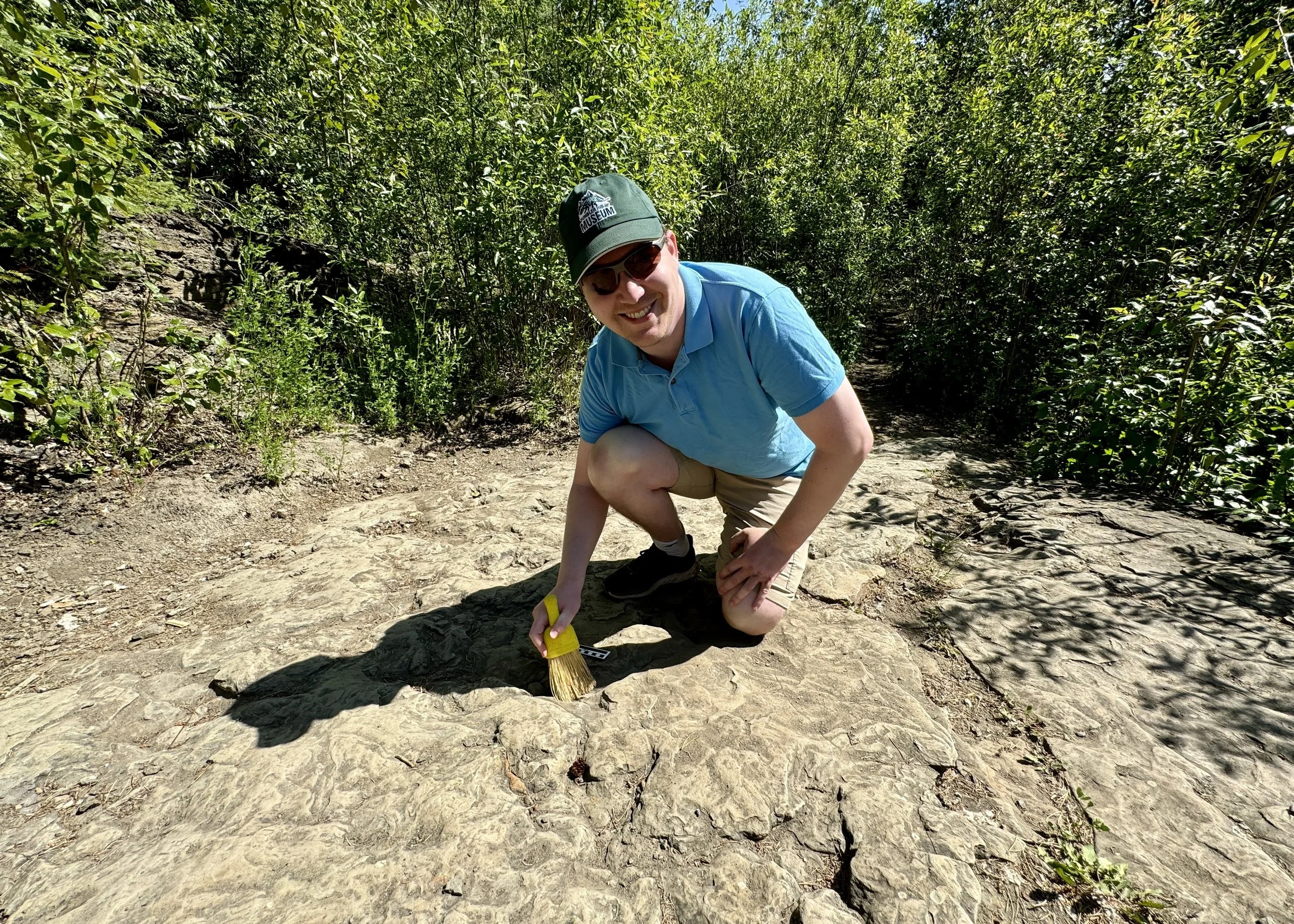
I’ve just explored the Dinosaur Discovery Gallery and met Dr. Charles Helm, the geopark’s scientific advisor on health who was there when his son found those first tracks with his friend. Now I’ve come to Flatbed Creek to see ankylosaur, theropod and ornithopod footprints in the rocks.
They’re 95 million years old, eroded and — I’ll be honest — hard to make out. But we’re allowed to touch them, brush them and even walk over them. I’m taken aback by the unprecedented access here.
“We’re just kind of relying on people’s respect for the fossils themselves,” says the museum’s collections manager Eamon Drysdale. “As well as the fact that yes we’ve done the photogrammetry (extracting 3D information from photos) and we’ve done what we can to preserve the trackway. We can’t physically take this out and take it to the museum and preserve it like that, so eventually this surface will erode to the point where we’re not going to be able to use it anymore. We hope that people have good intentions and are willing to just look at the tracks, brush them off and leave them as they are.”


I’m glad to hear that many of the geopark’s dinosaur sites are in remote areas and kept hidden from the public.
Ankylosaurs, I learn, were armoured herbivores that sometimes had massive tail clubs and walked on all fours. Their hind feet had four toes and their five-toed front footprints resemble crescent moons. Theropods were fast and agile carnivores who used two legs for walking and whose narrow trackways show three-toed prints that are often longer than they are wide. Ornithopods had stiff tails that helped them balance as they ran on hind legs. The prints of these herbivores were wider than they were long, with three fairly blunt toes and tiny handprints.
Maybe there’s something to people’s paleo obsessions?

The ancient prints I get to touch aren’t part of the original ankylosaur trackway. For that, we walk down a short path and gaze at the famous spot from across the creek. “There’s really nothing you can see nowadays,” Pettifer admits.
Still, it’s nice to imagine that carefree summer day when two boys went tubing and sparked a chain of events that would help save a community.


So, about that geopark. I suspect that most Canadians have no idea what they are and would be surprised to learn we have five of them. This one co-exists with coal mines that are eager to help.
New Brunswick’s Stonehammer launched first in 2010. Tumbler Ridge came four years later. Quebec’s Percé joined in 2018, followed by Nova Scotia’s Cliffs of Fundy and Newfoundland and Labrador’s Discovery in 2020. There are 213 geoparks in 48 counties (the United States doesn’t yet take part in the program).
UNESCO describes global geoparks as “unified geographical areas where sites and landscapes of international geological significance are managed with a holistic concept of protection, education and sustainable development.”


These designations let communities link their geological heritage to other natural, cultural and intangible heritages. There’s no impact on land use — and no funding. In fact, there are annual UNESCO membership fees.
“UNESCO in general has very poor recognition in Canada in comparison to European and Asian markets,” acknowledges this geopark’s executive director Manda Maggs. “I would say North Americans generally don’t have as much of an appreciation and understanding of UNESCO as other places. Europeans — 100 percent. UNESCO is like a five-star rating.”
The geopark gets half its funding from the district and the other half from running Tumbler Ridge’s visitor centre. Staff travel the region with a time machine (mobile interpretation trailer) full of what Maggs describes as “cultural objects and paleo stuff and anything about Tumbler Ridge that can inspire people to come here.”


Getting to Tumbler Ridge is half the fun. I fly from Vancouver to Fort St. John and then road-trip two hours south with an overnight in Dawson Creek. This remote region is part of the “Great Wilderness” which sprawls from the Coast Mountain range in the west to the Alberta border in the east, and from Hwy. 16 in the south to the Yukon border in the north.
In Charlie Lake, I sit in a cave at Tse’k’wa National Historic Site with executive director Alyssa Currie and learn how this “Rock House” has been a gathering place of the Dane-zaa for more than 12,500 years.
Designated in 2019, this federally recognized site is unusual because it’s run by the three Dane-ẕaa Nations (Doig River, Prophet River and West Moberly) instead of Parks Canada. A wheelchair-accessible interpretive trail tells the backstory with gorgeous corten steel signs depicting schist beads, bison and ravens.


In Dawson Creek, I pose at the iconic Mile 0 sign of the Alaska Highway before exploring downtown on a guided historical walking tour.
The N.A.R. Station Museum is home to a deliciously creepy vintage doll collection. The life-sized Gracie (Lady Grace) — a reproduction of an 1870 Victorian porcelain bisque mannequin — greets visitors to the Walter Wright Pioneer Village. Surely these community treasures qualify as cultural heritage?
As a wooden grain elevator lover, I know these abandoned prairie icons are fire hazards that are hard to repurpose, but somehow the Dawson Creek Art Gallery has taken over one. I ponder this victory over Vietnamese salad rolls from Juice Five O in the Kiwanis Performing Arts Centre. This is burger and wing country, so it’s important to celebrate diversity.


In Tumbler Ridge, I go all in on dinosaur fossils and outdoor experiences.
First, it’s a jetboat journey to magnificent Kinuseo Falls — which everyone will have you know is taller than Niagara Falls — in Monkman Provincial Park. Then it’s a hike along the Shipyard-Titanic Trail to see a rock tower that really does resemble the prow of the famous sinking ship.


There is wildlife — beavers and Bald eagles along the Murray River and a curious packrat that peeks out of the rocks at the base of Babcock Mountain beside the “Titanic.”
Both times my guide is Randy Gulick of Wild River Adventure Tours. Fun fact — in March 2019 he was the guy secretly tasked with hiding an Iron Throne for a global scavenger hunt to promote the final season of Game of Thrones.
Fans followed cryptic videos and hints to six spots around the world. Here, two local cross-country skiers connected to the geopark found the one by Babcock Creek south of town. Then for a few crazy days, fans descended on the town of 2,500 just to pose with the throne.


Gulick takes us to the spot where the throne once stood and tells us how he snowmobiled it in a crate to one remote site and then had it helicoptered to this more accessible roadside spot to avoid water damage from the melting creek.
He also shows off the GoT sword he got to keep. “Use this blade to make your quest” is etched into the blade. “Remembered for all time to come.”f
Geologist Kevin Sharman, who found the throne with his wife Birgit, told CBC it was a fun discovery but couldn’t compare to that time in 2015 when he found 100-million-year-old fossil crocodilian tracks here.

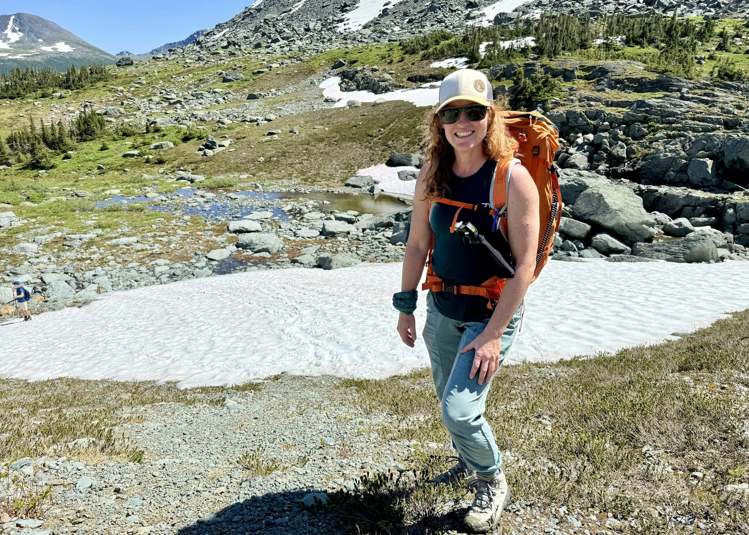

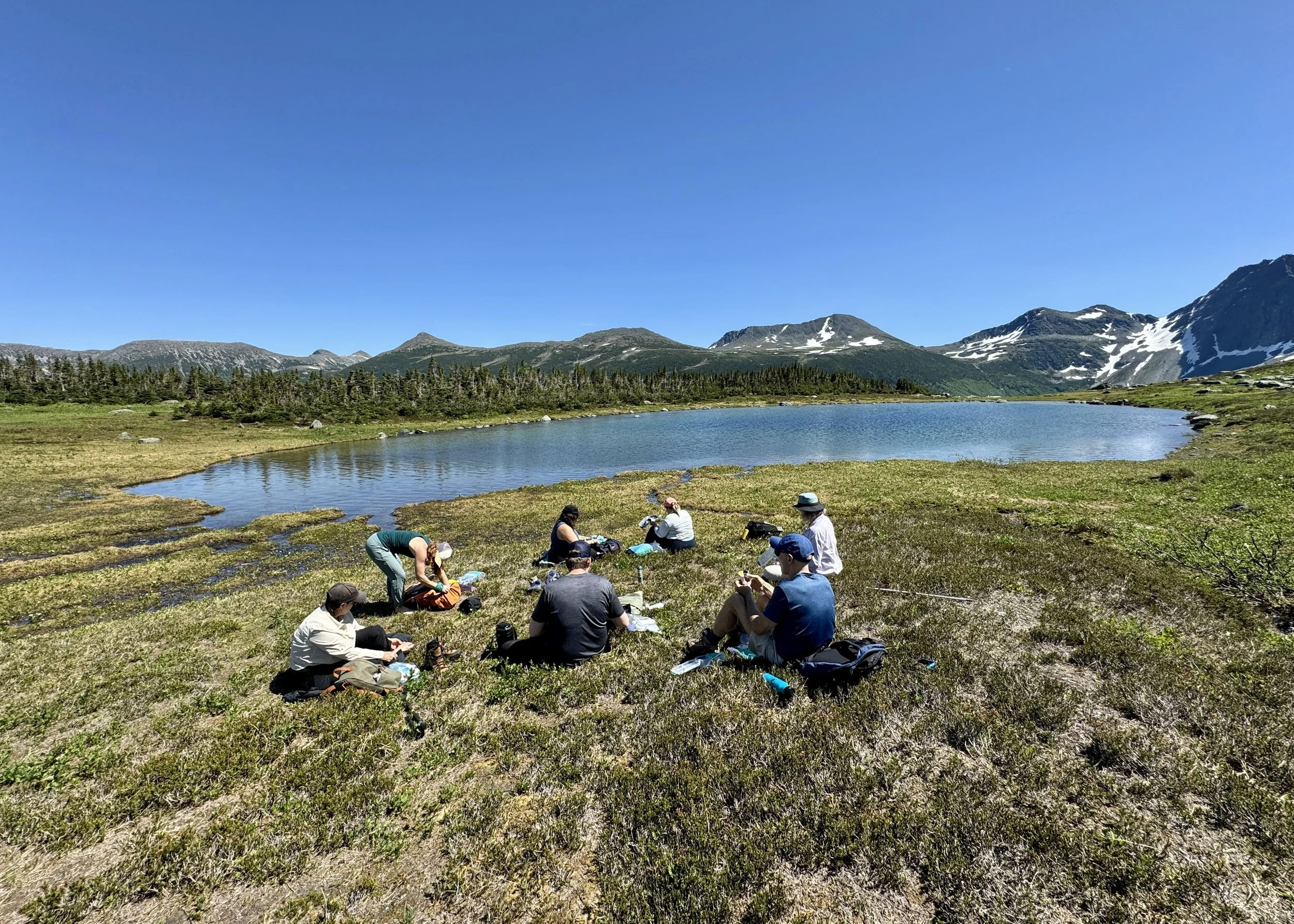


Speaking of helicopters, they’re part of my first heli-hike — a journey outside of my comfort zone.
“I have no agenda other than keeping you safe,” says Danielle (Dee) Roscher of Untamed Tours before giving us each a “toilet in a bag” kit for our day in grizzly bear country battling fierce July sun, aggressive mosquitoes and uneven terrain.
Ridge Rotors pilot James Horvath provides the lowdown on the chopper’s emergency locator transmitter and warns us never to deploy a fire extinguisher mid-flight. Then it’s up and away to a spot in the Hart Range that we pledge to keep secret.

Roscher asks us to share a number for our emotional, mental and physical well-being. I’m a tad shaky and say six, but after our “whoop whoops” keep the grizzlies at bay and I hold my own with veteran hikers in such an astounding place, that number climbs to 10.
Riding out an endorphin high, I climb back into the chopper to soar once again over paleontological and wilderness wonders back to Tumbler Ridge.


If You Go:
To safely catch a connecting flight from Vancouver to Fort St. John, you may need to stay overnight near Vancouver International Airport in Richmond. The Fairmont Vancouver Airport is inside the terminal and my room had views of the runway and a fun “YVR Plane Spotting Guide.” The AMTD Versante Hotel is a few minutes away and has a rooftop pool, but I loved seeing the Richmond Night Market (open Friday to Sunday) from my room and headed there for mango on a stick and mango sticky rice. The hotel options in northern B.C. are simpler and usually include free continental breakfasts. I stayed at the Pomeroy Inn & Suites Dawson Creek and the Trend Mountain Hotel & Conference Centre in Tumbler Ridge (where I liked having the Western Steakhouse in the building and used the coin laundry).
Jennifer Bain
After a career at daily newspapers, Jennifer began travelling the world in search of quirk in 2018. She goes wherever the story is, but has a soft spot for Canada and has been to all 10 provinces and all three territories. Jennifer has won multiple awards and written two cookbooks and three travel books. She lives in Toronto but has a vacation house on Fogo Island, Newfoundland, which some cheekily say is one of the four corners of the supposedly flat earth.